hover = elevation · scroll = zoom · drag empty space = pan
Existing structures & leach fields are approximate (traced from imagery + the 1996 plat) — drag to correct. Proposed ADU / homeschool / leach field are draggable; elevations update live from a 2 m DEM. Contours at 2 m (bold = 10 m).
Legend
Parcel boundary — APN 027-050-053 (official)
[P] proposed [E] existing
[P] ADU (custom build)
[P] Homeschool
[P] Leach-field investigation area (cross-hatch)
[E] existing structures / fields (approx)
Well (approx — locate)
Elevation contour
Marker names — edit to fix labels & overlap
Edit any label; the map updates live. Shorten them to stop overlap (zooming in also spreads labels). Auto-saves & exports.
Reference drawings — existing septic / leach field (Sonoma County records)
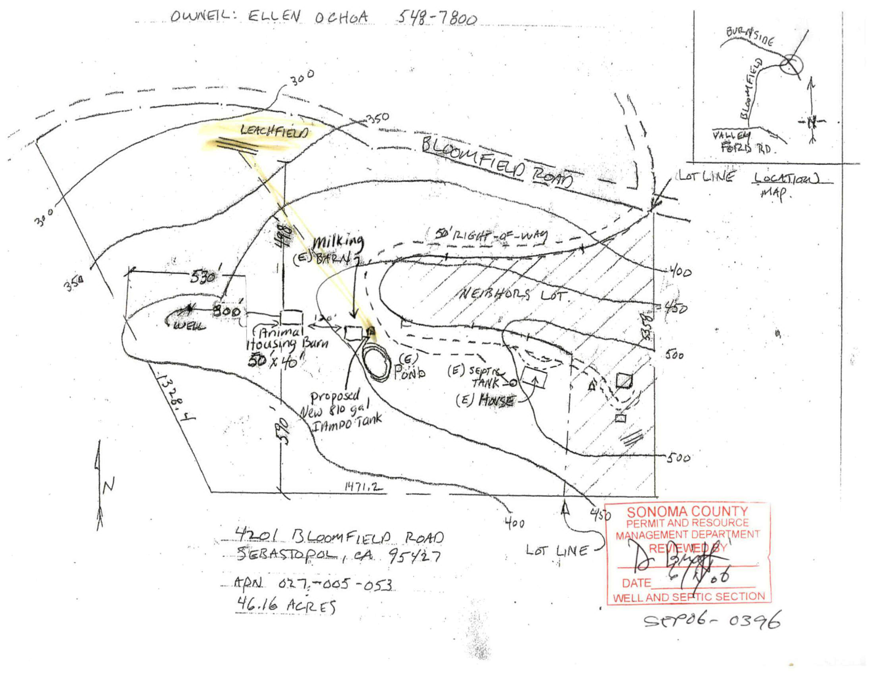
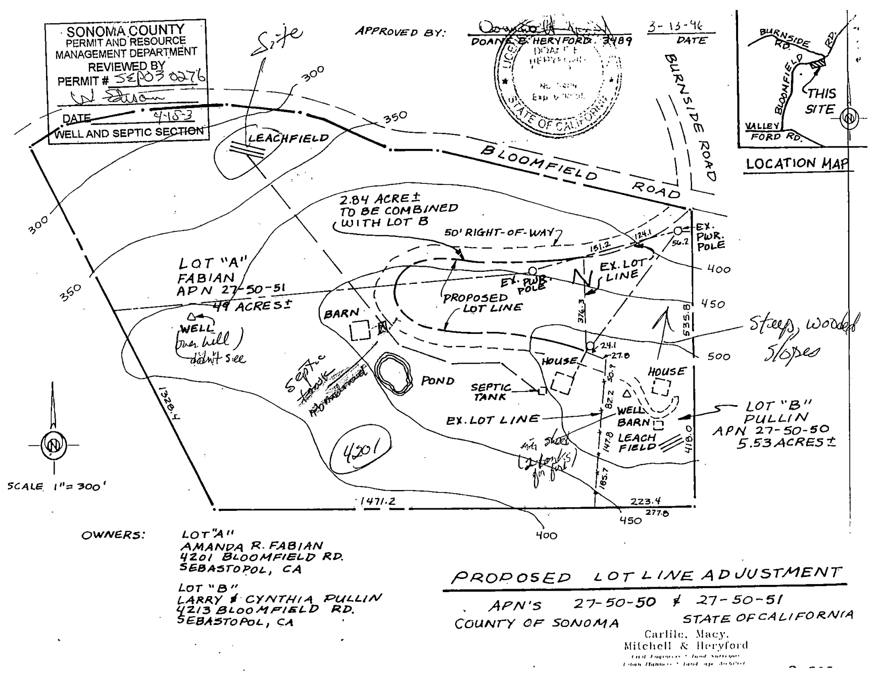
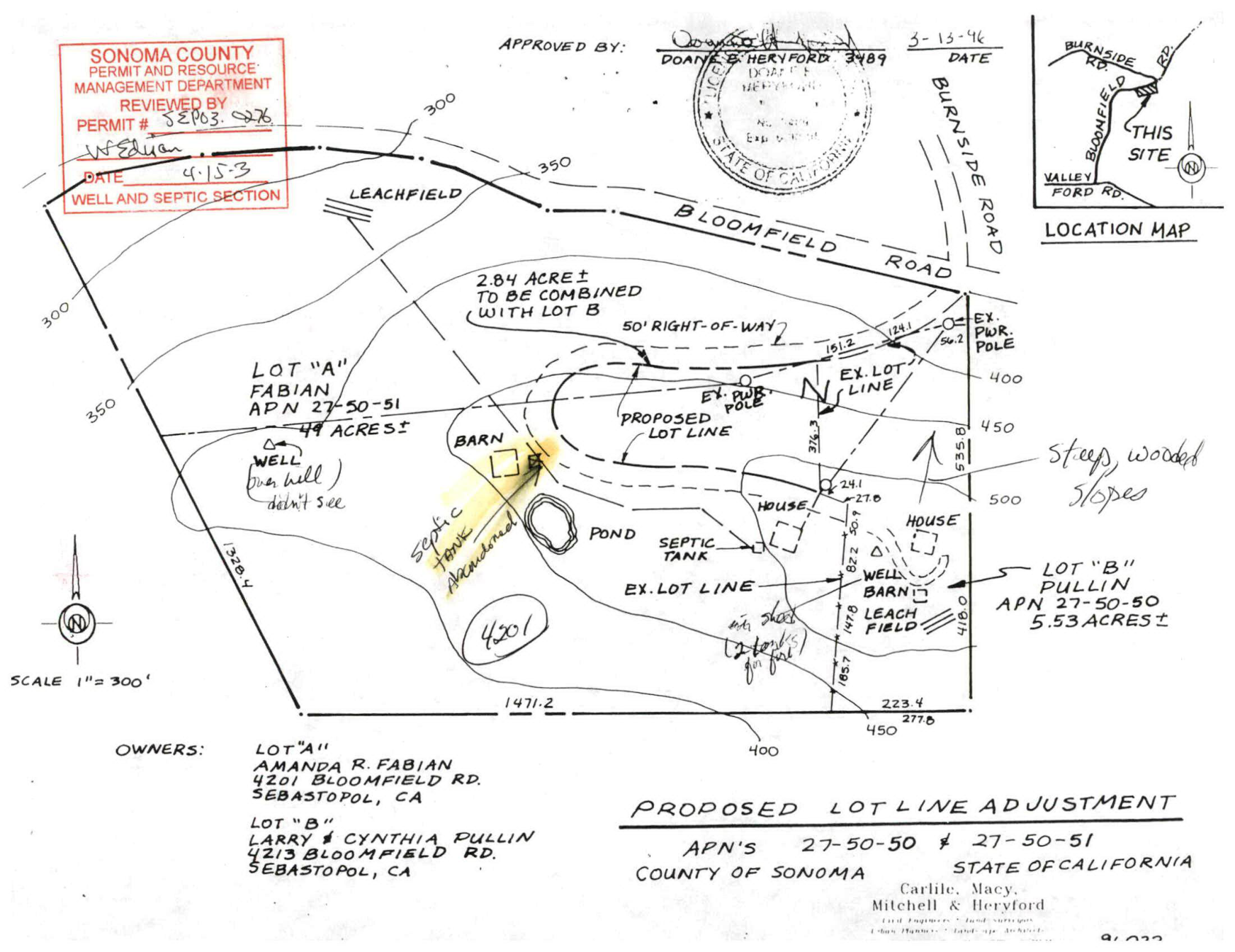
Source: Sonoma County PRA records (well-and-septic). Click any drawing to open full size. Hand-drawn / surveyed originals — use for orientation, not exact dimensions.
Advanced
Gravity feed — elevations & drops
—
Edit / save positions
Drag any marker to reposition (auto-saved in this browser). Export when done.